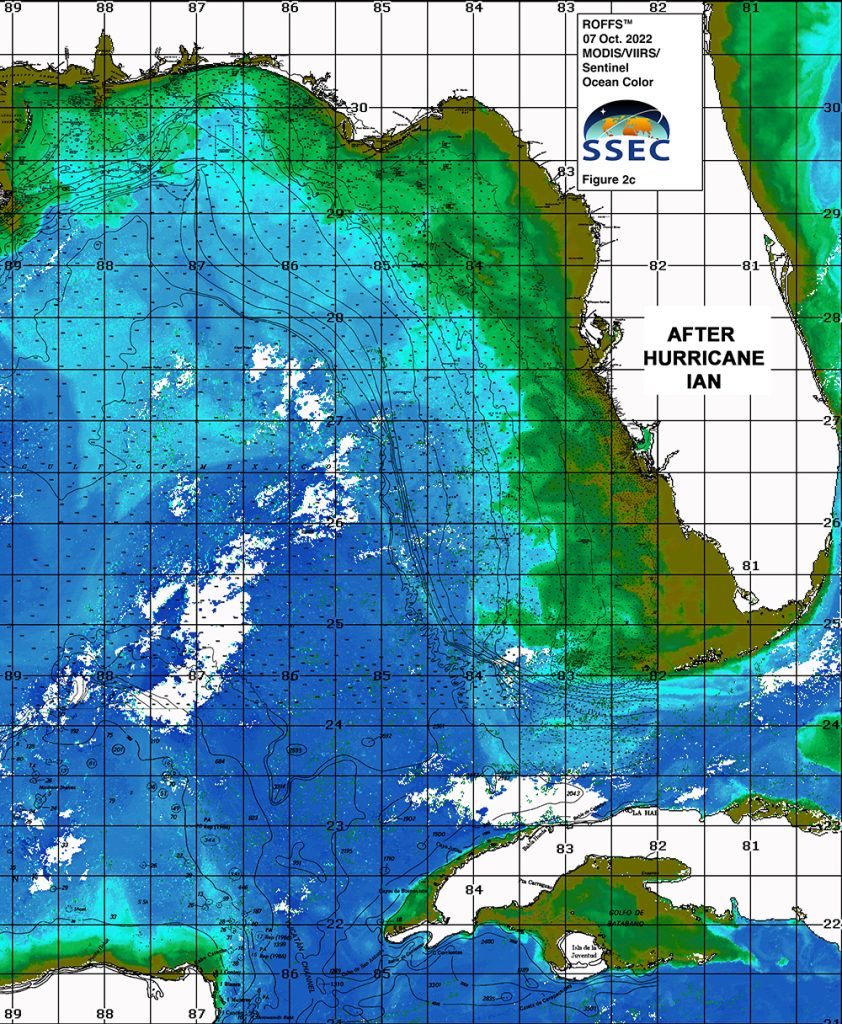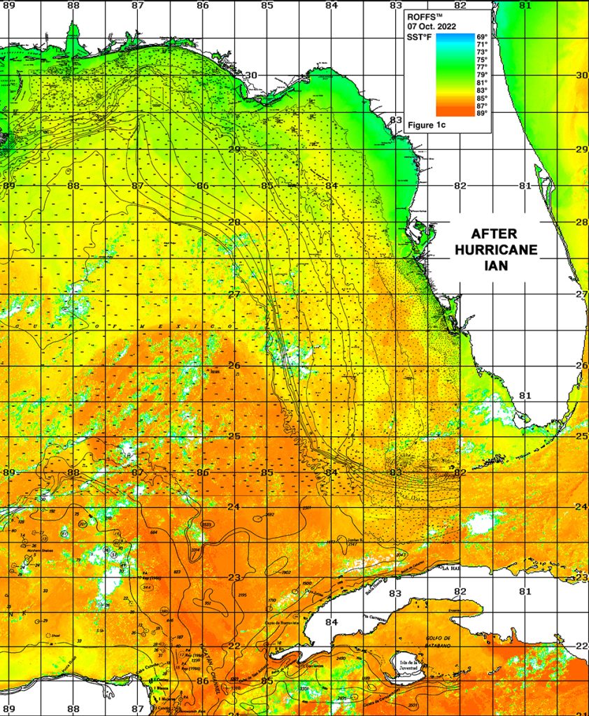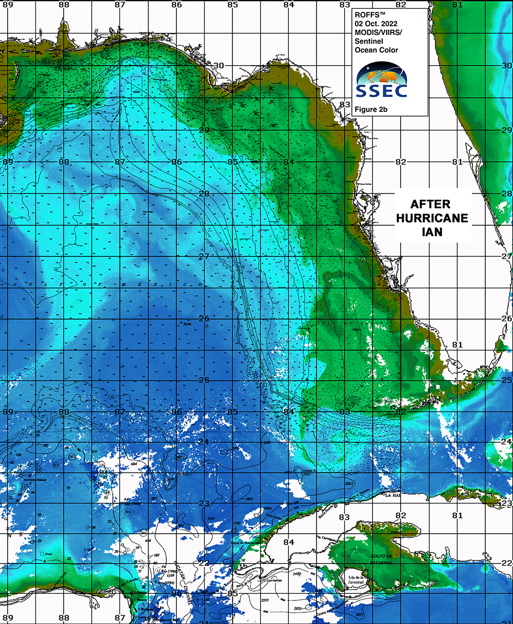
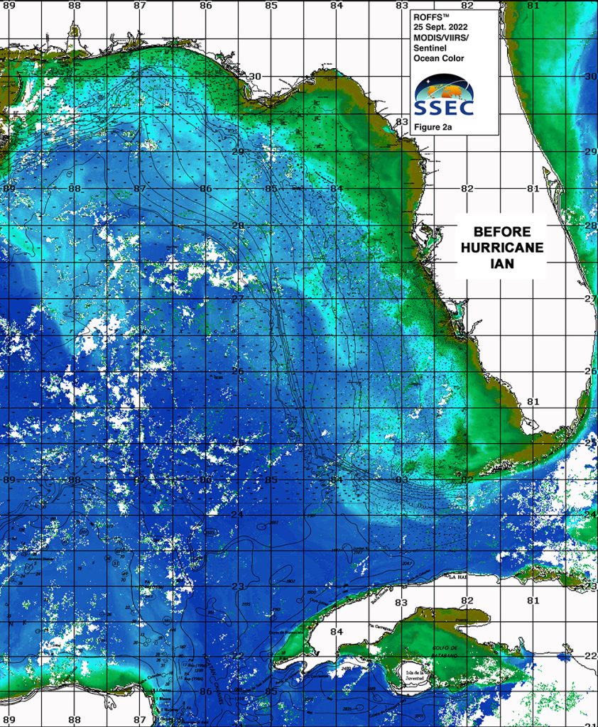
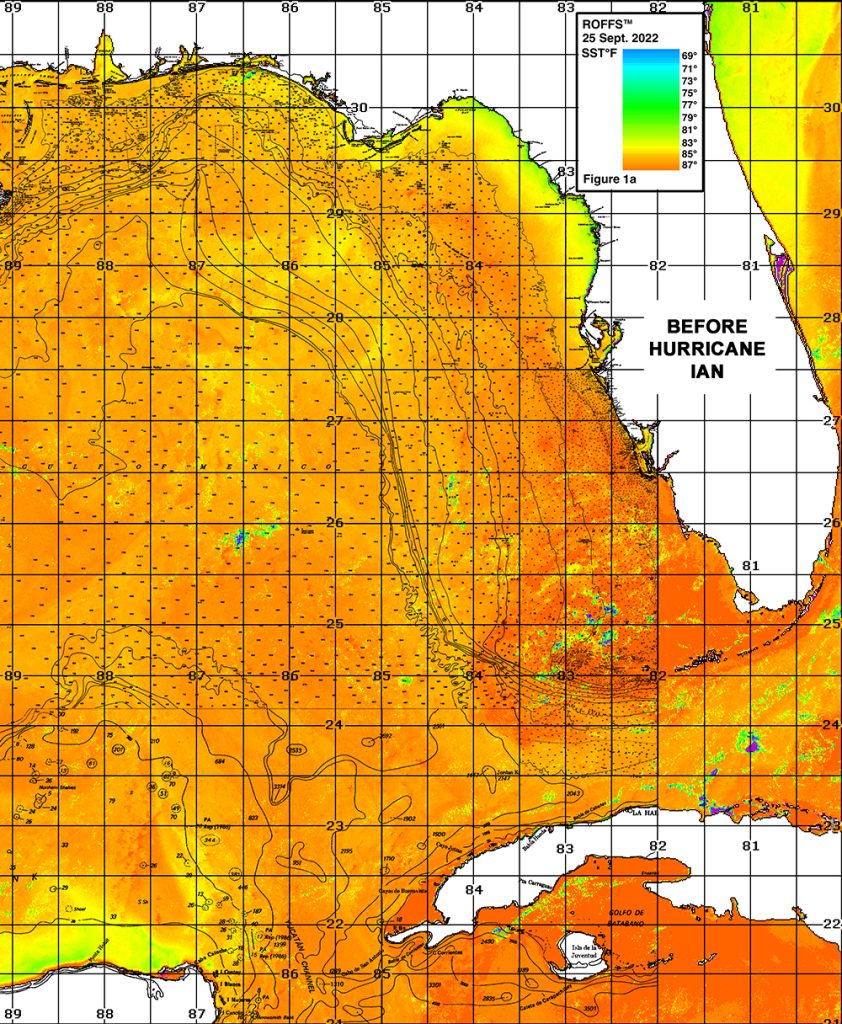
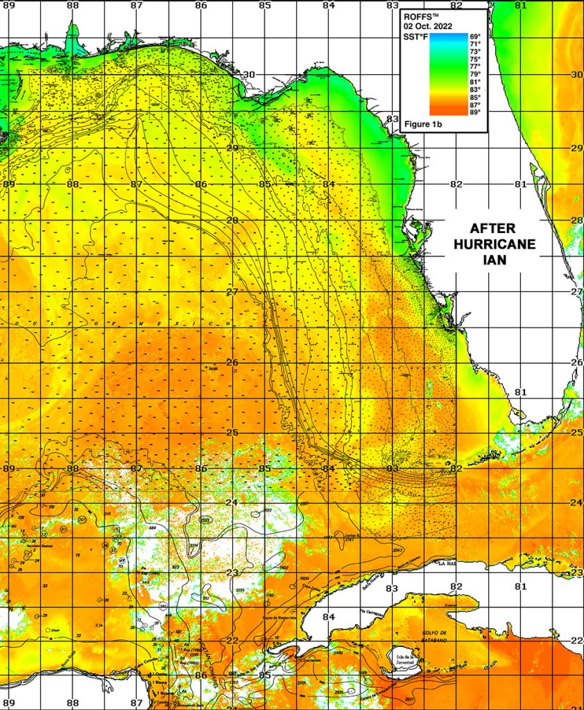
Using ROFFS™ high-resolution infrared sea surface temperature (SST) and MODIS, VIIRS, and Sentinel ocean color/chlorophyll satellite composite imagery we were able to observe large scale changes to the oceanographic conditions due to Hurricane Ian’s impact in the eastern Gulf of Mexico. We were able to observe a dramatic decrease in sea surface temperature throughout the eastern Gulf of Mexico, most notably along the coastal areas, as well as the inshore areas between Cape Canaveral and Savannah, Georgia. Additionally, we observed an increase in turbid green to blue green water inshore due to ocean mixing and runoff that pushed bluer water further offshore to the west and northwest towards the areas offshore of Tampa, over the Florida Middle Grounds and towards the area south of the Florida Panhandle. Some of this green to blue green water was also pulled offshore near the Marquesas into the Florida Straits towards the areas south of the Florida Keys. Our thoughts go out to those impacted by Hurricane Ian in late September.
Before Hurricane Ian
After Hurricane Ian (Oct 2, 2022)

After Hurricane Ian (Oct 7, 2022)