ROFFER’S OCEAN FISHING FORECASTING SERVICE, INC.
TOLL FREE 800 677-7633 & (321) 723-5759 // EMAIL: [email protected]
ROFFS™ FISHERIES OCEANOGRAPHIC ANALYSIS
FOR THE WILMINGTON CANYON TO NORFOLK CANYON OFFSHORE (LAT./LONG.)
UPDATED ON FRI. 11 MARCH 2016 FOR FRI. P.M. AND SAT. FISHING ONLY
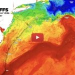
Based on a multiple factor analysis, the symbols (hot spot dots) mark the areas where the symbols (hot spot dots) mark the areas where bait concentrations are expected and where fishing action is expected to be better compared with other (non-marked) areas. These are not based on dock rumors or hearsay fishing reports. Fishing reports are stated as such. You should start fishing where you recognize other signs of good fishing conditions near these marked areas. It is very important to use your sea surface temperature (sst) gauge to locate the boundaries of the water masses, which are outlined. Rather than trying to find water based on the absolute temperature values shown on the map, search for the relative change in sst where the water mass boundaries occur. Arrows indicate the main current direction. Numbers inside of the dots indicate the number of consecutive days that we have seen favorable conditions in that location. Broken lines (small dotted lines) are water mass boundaries detected from the ocean color (chlorophyll + colorized dissolved organic material or “CDOM”) satellite data. Daytime sst are likely to warm 1°F-2°F.
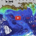
We have been able to monitor the ocean conditions for the last few days until this afternoon when cloud interference blocked our view. We are including our standard integrated analysis and an extra ocean color image today. An extended Gulf Stream meander pushed northward and a series of small counter-clockwise eddies pulled a pool of warmer water inshore that appears over the Baltimore Canyon to Norfolk Canyon areas. While the Gulf Stream meander appears as blue 75°F water over the 1500 fathom depths, the waters west blended with the coastal waters resulting in an algae bloom that turned the water from blue to green. The water over the 750-1000 fathom depths of the Baltimore Canyon is a darker green. It remains to be seen how deep this green water extends. There remains an extensive pool of green 64.5°F that has been creating very favorable water mass boundary conditions from the Baltimore Canyon to the Norfolk Canyon as there are five water mass boundaries with a sst change from 51°F to 64.5°F. As the Gulf Stream water moves eastward, the southern part of this pool is being pulled offshore, particularly from the Washington Canyon to the Norfolk Canyon. We anticipate that the water over the Poor Mans Canyon will also move substantially offshore this afternoon and tonight.
This suggests that over the canyon areas the best chances for fishing action occurs over the 500 fathom depths of the Baltimore Canyon particularly over the Vries Canyon (near 73°40’W & 38°05’N) where favorable conditions have existed the last three days and where the water appears to be bluer. It remains to be seen how long this water will remain blue because as the water moves offshore we are anticipating that this blue water will move as well. The remaining water will mix with the green. The best tactic is to travel rapidly to the 250 fathom depths near 73°45’W & 38°05’N and troll to the 500 fathom curve and work that area. One’s chances for bluefin tuna, yellowfin tuna and bigeye tuna, along with mako sharks and swordfish will be improved. It remains to be seen which water mass boundary will concentrate the fish.
If you can’t fish the Vries Canyon, then try the southwest side of the Baltimore Canyon. Keep in mind that south of the Baltimore the conditions are declining rapidly. Farther offshore over the 1000 fathom depths of the Baltimore Canyon the conditions are also favorable near 73°25’W & 38°04’N.
Relatively far offshore the western boundary zone of the blue water (71°F-75°F) also provides very good chances for fishing action especially over the 1500 fathom depths of the Norfolk Canyon to the Washington Canyon (73°50’W & 36°40’N to 73°40’W & 37°00’N).
If you can not fish the Baltimore Canyon or over the 1300-1500 fathom depths, then one’s chances for some fishing action will be improved from the 500 -750 fathom depths of the Poor Mans Canyon to the 500 fathom mouth of Washington Canyon. Keep in mind that the water over the 500 fathom mouth of the Washington Canyon remains blue colored and probably provides an advantage compared to the other areas to the Poor Mans Canyon. Try 74°20’W & 37°27-22’N.
Over the Norfolk Canyon the 1000 fathom curve (74°18’W & 37810’N to 74°20’W & 37°00’N) provides improved chances for fishing action as well as this water is blue and the water mass boundary has been seen for the last three days.
Verbal updates are free between 10:30 AM and 11:59 AM (eastern time) only, please call. Thank you for not sharing this analysis with non-paying fishermen. We survive on your honesty. Winter hours Jan 02 – March 25, 2016 Mon-Fri. 09:00 AM-5:00PM, Spring hours: March 28 – April 29 Mon. – Fri. 09:00 AM – 6:00PM & Sat. by demand by Wed. 5:00 PM. Remember you can order and/or purchase your fishing analyses from our website (https://roffs.com/ and press and hold on Order Analyses button) or by email. The ROFFS™ Graphic analysis is on the next page.
Please CLICK HERE to download analysis as a PDF.
[responsive] 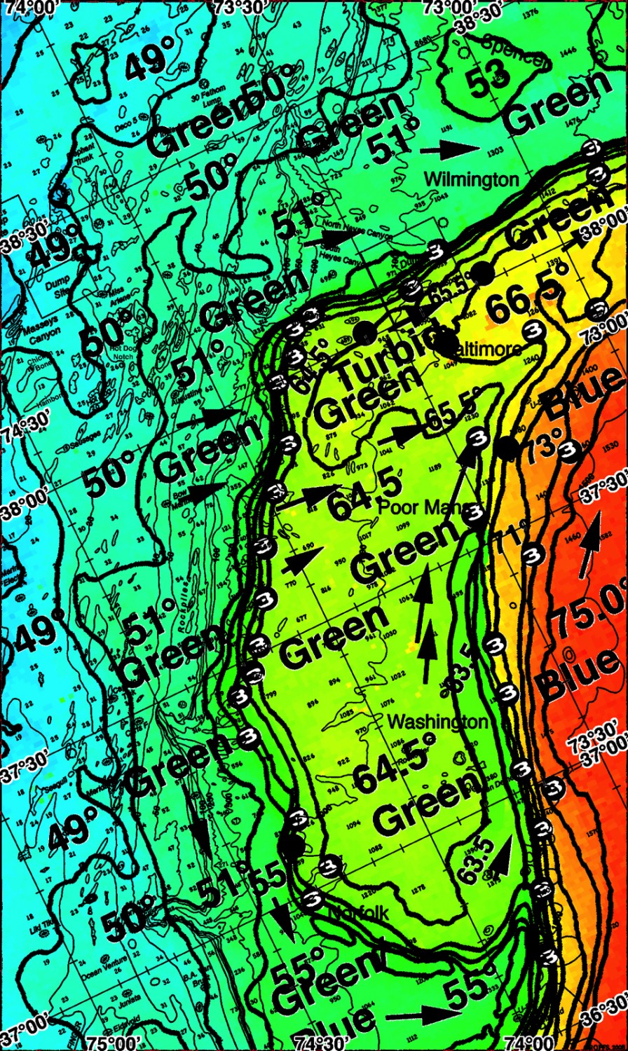 [/responsive]
[responsive]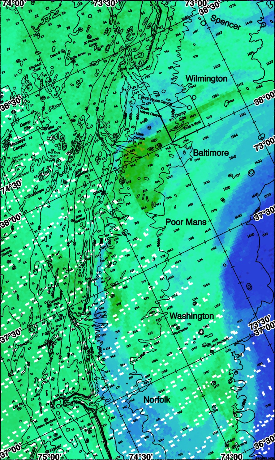 [/responsive]