Article courtesy: outerbanksvoice.com | By Rob Morris originally published on April 30, 2015 | Please click here for original article.
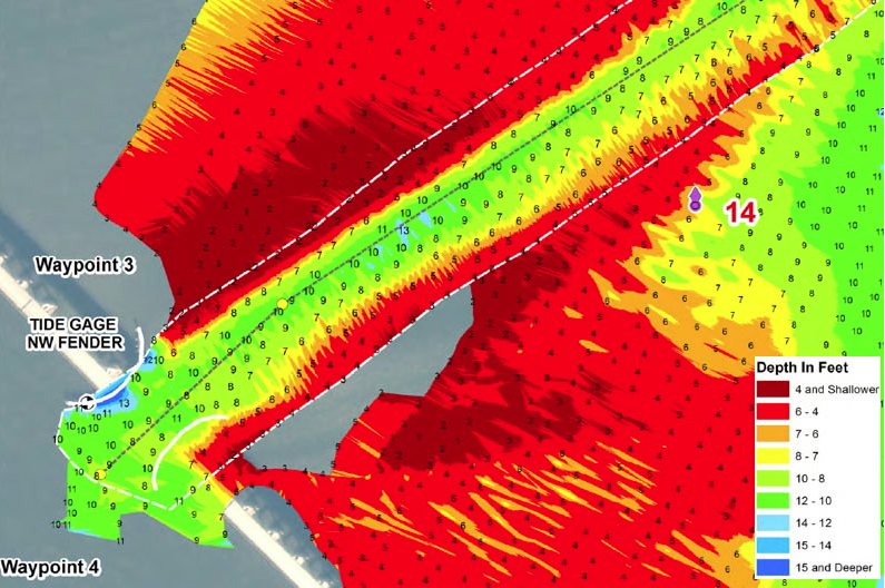
Above: The dredge Currituck has cut a channel 8 to 10 feet deep. (ASACE)
The Coast Guard lifted all restrictions Thursday in a regulated navigation area at Oregon Inlet that was established to protect the Bonner Bridge.
An area within 100 feet the bridge had been limited to vessels with drafts of 5 feet or less because of shoaling in the main navigation channel and other routes that boats were taking.
Earlier this year, the restriction applied to boats drawing more than 2 feet of water.
A survey taken by the Corps showed a channel about 8 to 10 feet deep. The dredge Currituck continues to work 24 hours a day to enlarge the cut.
Up-to-date surveys of the area are available for mariners here.
The Coast Guard advised that mariners continue to use caution when navigating Oregon Inlet.
“The navigational aids in Oregon Inlet and Oregon Inlet Channel are not charted and may not be marking best water due to continually shifting shoals,” a Coast Guard statement said.