ROFFS™ Handy Simple Guide to Tropical Storm Development
As we are in tropical weather season we wanted to provide some basic information for you to better evaluate the development and likely motion of tropical depressions, tropical storms and hurricanes. We are providing this based on our observations, training and experience as oceanographers, and we remind you that we are not meteorologists. However, as we have been hearing and reading some misleading statements by the media weathermen and weatherwomen and media meteorologists we thought that by providing you this simple guide that you will be able to begin to understand the development and likely motion of these tropical systems.
When watching such systems we think that you should:
Evaluate the central pressure of the system; If dropping below 1010 millibars atmospheric pressure it is likely that a depression or storm is developing. If below 1000 millibars pressure, it is likely you are dealing with a dangerous hurricane.
Evaluate if the major cloud masses are oriented symmetrically around the center of circulation. If not then development is not as favorable compared with if they are centered around the atmospheric low and all the clouds are moving in the same direction (counter-clockwise) around the circulation.
Evaluate all tropical storm models for patterns of agreement. Some models are better at tracking particular types of storms than others.
Evaluate if dry air or cool air is being pulled into the storm. This will tend to be unfavorable for storm development. Warm moist air favors development.
Evaluate where the jet stream and major weather fronts are located and how they moving. Are they are moving toward the storm and thus may pull the storm to the frontal boundary and weaken development.
Evaluate the location of the Bermuda high and the likely effect it will have on steering the developing storm.
Evaluate how fast the depression is moving over water or land. Slow motion (0-10 km/hr) suggests development is likely. Faster speeds (e.g. 20 km/hr) suggests unfavorable conditions for development.
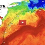
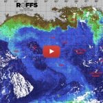
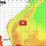
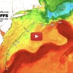
Evaluate whether the depression/storm is over water warmer than (26°C or 78.8°F) then favorable for further development. Tropical systems that are over the Gulf Stream and relatively large eddy features are likely to develop and intensify as the warm water supplies energy to the storm.
Consider how far the system is away from you and how many days it likely to start influencing your weather.
This is just a short list for you to start using to evaluate systems. Of course one should listen and evaluate the NOAA data, forecasts and warnings. However, there are plenty of other government, academic and private weather services that provide excellent interpretations of the weather conditions. We refer to many private and publically available meteorological services. We have an extensive list that we use. One we like is by Jyotika Virmani on the internet and Facebook (http://jyotikastorms.blogspot.com/). Dr. Virmani (Ph.D.) provides her interpretation of the conditions, as well as, a bit of British – Indian – American humor and magic. She is also a friend and colleague. Search the internet for others. Use the internet for large scale satellite imagery, as well as, combined satellite and pressure products along with interpretive products. The GOES satellites (infrared, visible, water vapor channels) are great for this. The higher resolution polar orbiting satellites are very useful too, along with airplane and ship reports. All available on the internet.
Please remember that your health and safety are more important than that one more fishing trip that you can make up later. However, with education, data and experience you can plan your trips within a reasonable weather window with safe conditions. Don’t let the media weather hounds lead you on with unrealistic, relatively long term (three to five day) hand waving warnings and forecasts.
Safe and Successful Fishing,
Mitchell A. Roffer, Ph.D.
President