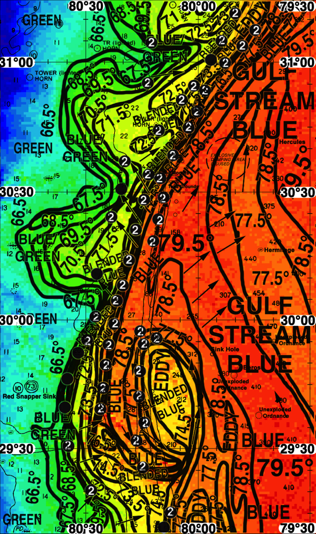
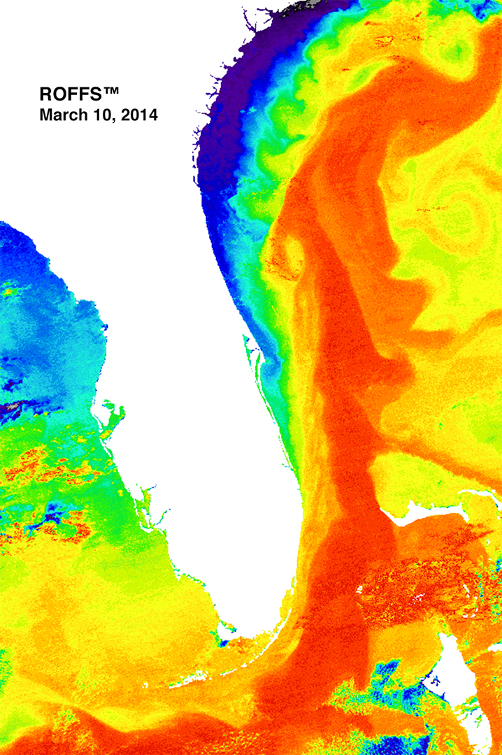
Wahoo fishing between Daytona Beach and Jacksonville Beach, FL has been outstanding this winter season after the cool waters moved southward a few weeks ago compressing the wahoo’s preferred thermal habitat. In addition, there have been a series of relatively slow moving and relatively large counter-clockwise Gulf Stream eddy features moving northward from the Cape Canaveral area. These eddy features pull substantial filaments of Gulf Stream water over the good bottom structure inshore of the edge of the continental shelf break (100 fathoms – 200 meters – 600 feet). As the water mass boundaries have been stable for three to four days there has been time for the ocean convergences along the water mass boundaries to concentrate bait fish. The persistence of these ocean frontal boundaries have allowed the wahoo to find and concentrate where their prey is concentrated. An example of this is show in the colorized infrared satellite imagery derived from NOAA and NASA satellites on March 10, 2014 that extends from the Florida Keys to Georgetown, SC. Note the Gulf Stream eddy and relatively warm (red color) Gulf Stream filament along the western side of the Gulf Stream. In this case note that the relatively cooler water (blue and green) is being pulled toward the filament bringing coastal prey species offshore and creating an even stronger set of thermal gradients that increases the convergence.
Wahoo fishing action was off the charts (excellent) on May 10, 2014for several boat and is expected to be excellent today particularly between Jacksonville and St. Augustine. We also anticipate that the eddy will continue moving northward where the fishing action will start to improve, but as the eddy moves northward water over the Daytona Beach to Jacksonville Beach, FL will begin to be pulled offshore signaling a decline in the fishing action. For more reports on the fishing action off northeast Florida follow the Northeast Florida Wahoo Shootout fishing tournament on their website and Facebook pages: http://www.wahooshootout.com and https://www.facebook.com/WahooShootout.
The second image is the ROFFS™ Fishing Oceanographic Analysis graphic (without the full page text discussion) from March 10, 2014. Unfortunately we have only been able to see the conditions clearly from the last two days and thus were only able to mark the favorable conditions (hot spot dots) based on two days of satellite imagery. However, this image analysis clearly shows the water temperatures, water mass boundaries, direction of the water, as well as, identifies the eddy feature.