Oil & Gas

ROFFS™ Oil and Gas

ROFFS Ocean Fishing Forecasting Service, Inc. (ROFFS™) is a scientific consulting company based in West Melbourne, Florida (U.S.A.) that has been providing consulting services to the petroleum oil and gas industry for the past 30+ years. While we are primarily known for providing worldwide fisheries oceanographic consulting service, our involvement with the oil and gas industry has expanded and now offer our services to the oil and gas community worldwide.

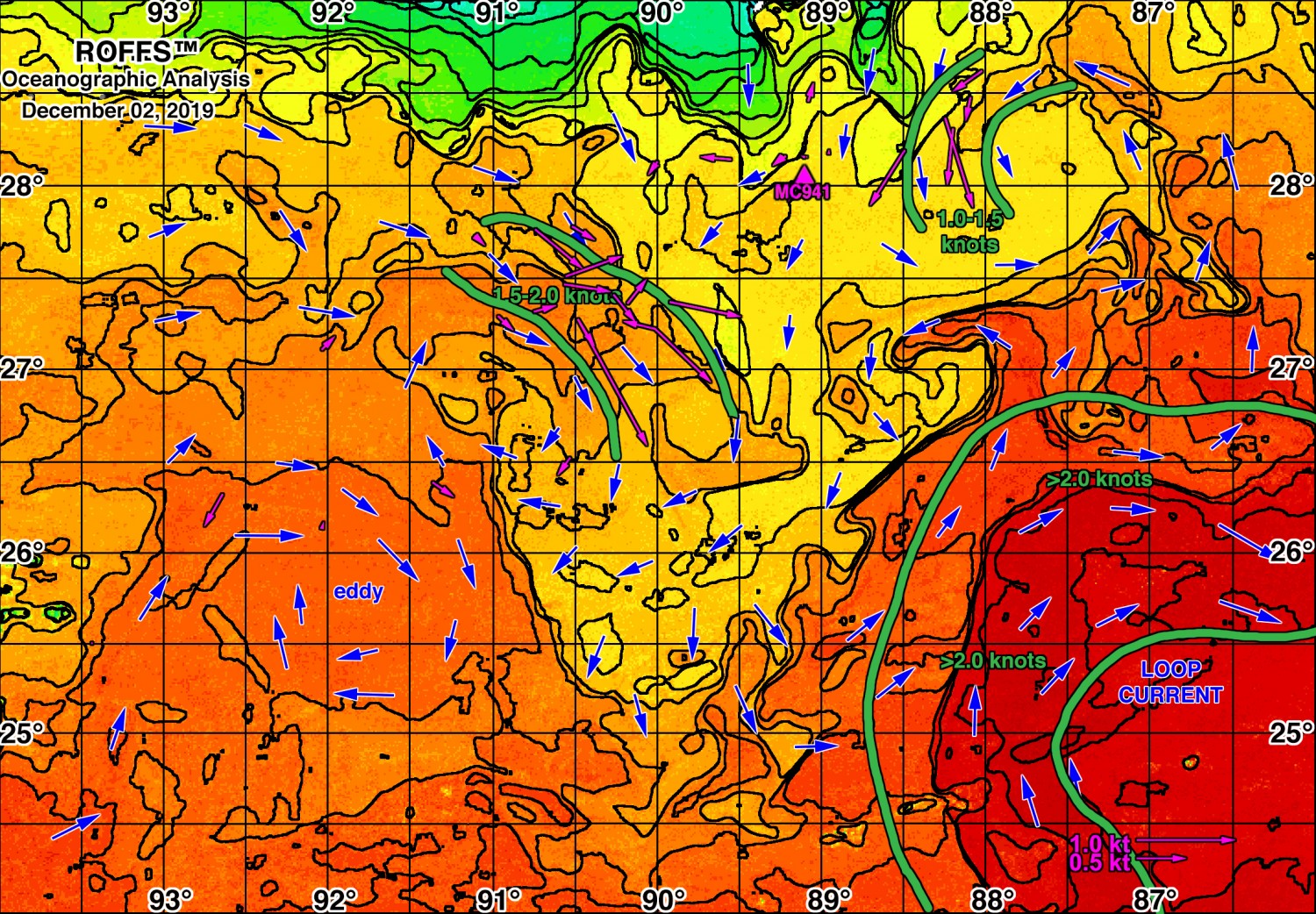
Our products are designed to provide real-time detailed information on ocean currents to maximize the operational efficiency and for risk abatement. ROFFS™ integrates infrared, ocean color chlorophyll, altimeter, radar, current meter, and meteorological data and produce a detailed oceanographic analyses. Depending on the project we also partner with other companies that allows us to provide the best solution with the lowest cost to the client. This includes response and horsepower forecasting. We have a team that uses advanced satellite image interpretation, private-industry developed numerical weather and current models, as well as, simulators to monitor and predict operational efficiency. Based on specific parameters of the client needs, we are also able to provide clients with different geographic coverage, with variable spatial and temporal resolution solutions to provide the most cost effective service.

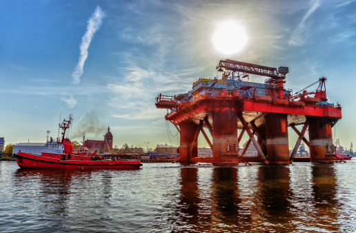
In an effort to keep up with the rapidly changing requirements and demands of the oil and gas industry, we formed a joint venture with Schaudt.us to provide a variety of services including oceanographic analyses and forecasts in support of deep water drilling (construction and operations), ocean tows and rig transports, as well as, seismic operations. Having supported offshore operations and engineering design since the early 1980’s, ROFFS™-schaudt.us have proven their ability to help clients operate effectively with eddies and fronts in order to maximize operations efficiency and safety.

Expert Interpretation and Technique

ROFFS™ employs the top oceanography graduates and image analysis experts who conduct oceanographic analyses. We are experts in observing ocean circulation features from a variety of space satellites under varying atmospheric conditions. We remain active in NASA funded science, with other research scientists, and application developers.

Providing comprehensive oceanographic analyses is an intensive process that requires expertise in a variety of scientific disciplines including physical oceanography, satellite remote sensing, image analysis, and computer science to name a few. ROFFS™ has developed advanced image analysis techniques, particularly when working with water motion and clouds. This allows us to provide useful information more often than others. We do not limit our analyses to simple sea surface temperature contour maps or pretty color images that often only provide a combination of cloud cover, other atmospheric effects (e.g. uneven humidity, fog, haze) and computer artifacts from automated processing of the satellite data. It certainly will not allow you to understand the changes in the short-term history and motion of the ocean currents that are critical to operational efficiency. ROFFS™ uses infrared, ocean color-chlorophyll, altimeter, radar, current meter, and meteorological data that are integrated into our analyses.

Energy Solutions

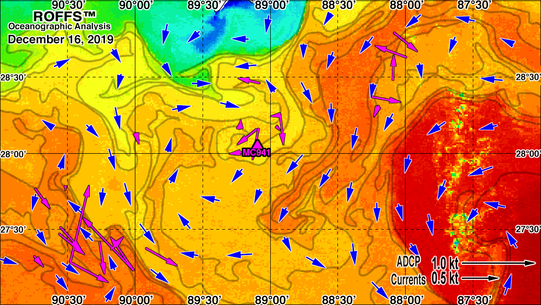
The ROFFS™ Oceanographic Analysis is designed to optimize operational efficiency, safety of drilling and navigation, voyage performance, and fuel conservation. The analyses are composed of a map and a text summary that are designed to identify ocean currents and provides a representation of the ocean conditions that presently exist, a short-term forecast, and the future conditions. The analysis is the result of studying the ocean conditions for several days while focusing on the most current conditions that may impact operations and safety.

Accurate analyses and forecasts must start with the best depiction of the recent ocean conditions. ROFFS™-schaudt.us Oceanographic Analyses and Forecasts start with synoptic analysis prepared from real-time infrared, ocean color, chlorophyll, altimeter, radar, current meter and meteorological data. Geographic coverage, spatial and temporal resolution are varied to meet the needs of the clients in a cost effective fashion. Presently, daily support is provided for Trinidad and within the north central Gulf of Mexico. On demand service can be provided worldwide including the Gulf of Mexico, Canada, Cuba, the Caribbean, South America, South Africa, and within the Indian Ocean to name recently serviced locations. In addition to our primary product, the comprehensive analysis, we are able to provide animated GIFs of water motion, a large scale overview analysis of conditions for long term planning, chlorophyll and salinity depictions of the current ocean circulation at the site, as well as, current speed site forecasts throughout the water column. To get a quote for service, fill out form below.

By blending Oceanographic Analyses, current models and vessel simulators, our team is able to verify optimized route guidance and extend the range of coverage. Presently, our support of long-distance tows and shorter rig moves allows the client to minimize delays and save time. In one tow, the client reported that seven days were saved on a 40-day tow. To learn more and get a quote for service, click here.

In tow forecasting, the simulator is used to forecast the speed and response of the vessel during transit. For fixed operations, such as drilling in the northern Gulf of Mexico, the simulator is used to model and forecast the heave, pitch, roll and orientation. The simulator was generalized to predict the full electrical power demand on cruise ships which requires tracking the weather and currents, as well as, the variation throughout the day. For dynamic-positioned operations, this same technology can be used with the Oceanographic Analyses to optimize the scheduling of power between station keeping and drilling.

Since the late 1970’s, team members have provided metaocean, hydrodynamic and oceanographic support for operations and design worldwide.

Supporting drilling; pipeline and construction operations; seismic; shipping; LNG transport; oil spill response; environmental assessment and monitoring; engineering design and operational planning.

Ocean Features and Circulation Using Models

Our experience suggests that the current version of ocean models available from the government and academic sectors still do not provide useful results for real-time monitoring of ocean currents. The temporal resolution and geographic coverage of the output is insufficient. Many times the model output is days late and uses data from over 7-10 days, as well as, historical data to fill in gaps. In addition, the outputs provide incomplete information as many important ocean features are missing compared with the actual observed currents. ROFFS™ has been successful in blending our real-time oceanographic analyses with models developed and operated by private industry oceanographers and meteorologists, only when necessary. The importance in using the real-time satellite data cannot be understated when detail is critical for site operations.

Information Request Oil/Gas/Monitoring/Routing

For a complete package of information and a customized quote please fill out our information request form.
Fill out this field
Fill out this field
Please enter a valid email address.
Fill out this field
Service Desired
Select an option
Fill out this field
19 - 1 = ?
Enter the equation result to proceed