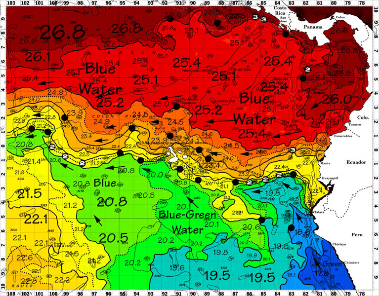
The “ROFFS™ Fishing Forecasting Analysis” is a combination of a sea surface temperature ocean frontal analysis, and fish finding map that includes a full page text. The products are used to locate productive fishing grounds and avoid areas that are mostly likely to be unproductive. The map provides a reproduction of the ocean conditions that the staff fisheries oceanographers observe and expect you to find during your fishing trip. The analysis is the result of studying the ocean conditions for several days using a variety of space satellites, buoys and other data collection platforms. The text portion is truly unique. As subtle changes in the ocean conditions often have great consequences when locating fish, it provides details on the locations and conditions that will be particularly productive. The product has been so successful in the Spanish tuna purse seining industry off Africa that their clients have stopped using helicopters for spotting. The best areas are clearly indicated based on 30+ years of research and development. The favored areas are marked as “hot spot” dots. The number of days that the favorable conditions exist are indicated inside the dots. The longer the conditions are favorable, the greater chance of finding concentrations of fish. The files sizes of the analyses are small and thus, cost effective for satellite email transmission. These products allow the captains and fishing masters to make educated decisions at sea and reducing the risk of going the wrong direction and losing valuable time. They are logical to use and do not require expensive or sophisticated computer hardware or software. These operational forecast products are all available in color via email or black and white via standard office facsimile machine.
ROFFS™ reports that “the fishing forecasting analyses have been so successful that they are a well protected secret in the industry”. The company is now searching for additional sales representatives overseas. Please send an email to fishing@roffs.com if you are are interested. They are particularly looking for people experienced with satellite communications and marine electronics.


