Government climate experts reported Monday that the world’s oceans set a record last month for the highest average July temperature — 62.5 degrees.
The warmer waters are putting stress on coral reefs.
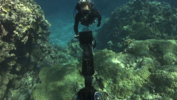
Just off the Florida Keys, these divers are taking the ocean online.
No one’s happier about it than Sylvia Earle.
“We’ve invested in technologies that enable us to map Mars and Jupiter and the Moon, and the universe beyond, but we’ve been missing out on mapping the ocean,” says Earle.
Earle, the world renowned oceanographer, is part of a project that’s documenting the ocean’s coral reefs the same way Google maps our streets.
In the past 30 years, an estimated 40 percent of corals worldwide have been lost.
Those corals protect shorelines, fisheries and sustain a big tourism business.
“Right now it’s like the ocean is too big to fail. Right? Well no, it is failing. It’s up to us now. Armed with knowledge.”
The knowledge comes from these special cameras and the Catlin Seaview Survey. They have already taken more than 400,000 images.
Richard Vevers is the project leader. “It’s really being able to photograph the reef at scale. So traditionally you would send in a diver. And they would go and photograph using a normal camera and they might be able to do a hundred meters in a dive and it would take them an hour. We can do two kilometers with full 360 [degree] data and a thousand shots in less time.”
After visiting 20 other countries, this is the team’s first step into saving coral in American waters.
“I know what it was like. I know what’s missing. And I know what it can be again. … It’s starting here in the Florida Keys. And it’s working here. We just need to give it a little more time,” says Vevers.
A little more time and a lot of new technology are taking our understanding of the ocean into a whole new age.
Re-posted from CBSNews.com August 18, 2014 – Please click HERE for original article.


