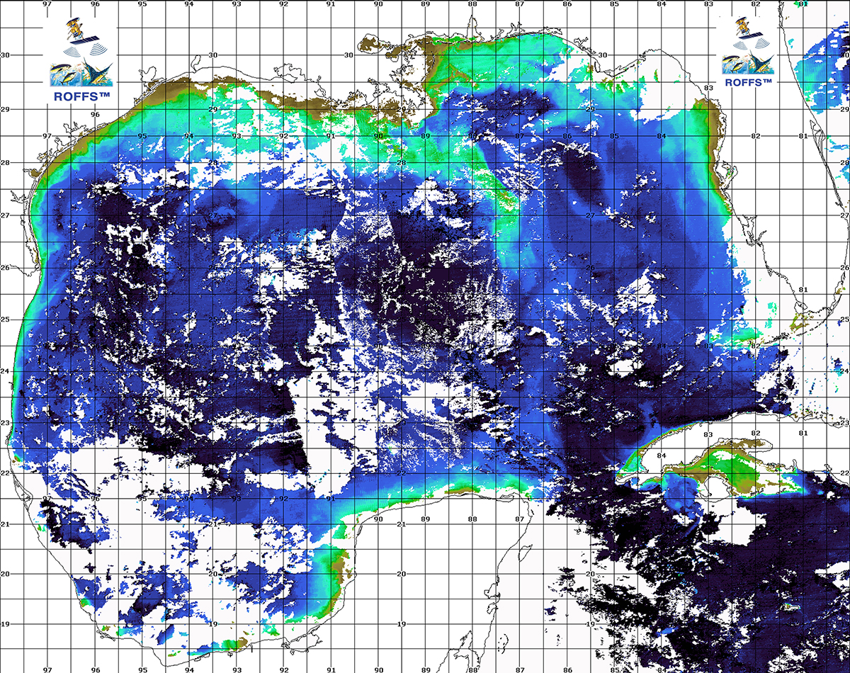
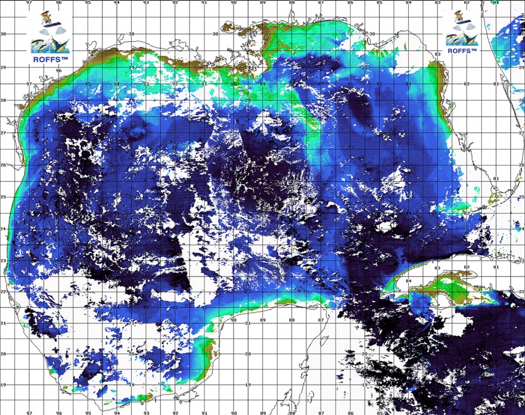
We have combined some satellite images from a variety of ocean color satellites (Aqua, Terra, and Soumi_NPP) to provide this single representative image of the Gulf of Mexico. There remains many clouds and artifacts in the image, but that is the nature of clouds and satellite data.
There are several items of interest. The dark blue Loop Current remains depressed and the northern boundary appears west of Key West (along 24°30’N between 86°00’W and 84°00’W). There is a relatively large clockwise Loop Current eddy centered in the middle of the Gulf of Mexico approximately near 89°00’W & 25°45’N. This eddy is pulling green coastal water offshore south of Louisiana in a southward direction. There is a hammerhead pair of eddy features south of Mississippi, Alabama and western Florida. The eddy centered near 87°00’W & 28°45’N is rotating in a clockwise direction, while the eddy centered near 88°15’W & 28°15’N is rotating in a counter-clockwise direction. Both of these eddy features are pulling green water toward them. There is an elongated blue water eddy south of the Florida panhandle centered near 85°45’W & 27°45’N which is rotating in a clockwise direction pulling blue water to it. Off the west coast of Florida there is a substantial pool of blue water. East of Texas there is counter-clockwise rotating eddy centered near 96°20’W & 27°00’N that is pulling blue water that originates in Mexico in a northward direction. The dark blue Mexican water is moving north-northeastward. Note the green water along the eastern coast of Mexico and east coast of Texas which stems from coastal upwelling due to the winds and the currents. The green water along the southeastern coast of Texas is being pulled eastward and actually is mixing with the Mississippi River water before being pulled southward.
A more comprehensive analysis of the ocean conditions would take pages to cover and while it would be fun to provide it is not the intention of this note to consider all the subtle details related to the concentrations of fish and their association with different water masses. Remember that this is a dynamic ocean and conditions are changing significantly every day as the water moves and mixes with the surrounding waters. It is the persistence and strength of the water mass boundaries, flow of the water, color and clarity of the water, and many other factors that determine the likely concentration of fish. Ultimately it is the subtle factors that are related to the occurrence of feeding concentrations of fish. These aspects are covered by the ROFFS™ daily oceanographic fishing forecasting analyses.
Safe and successful fishing,
Mitch

