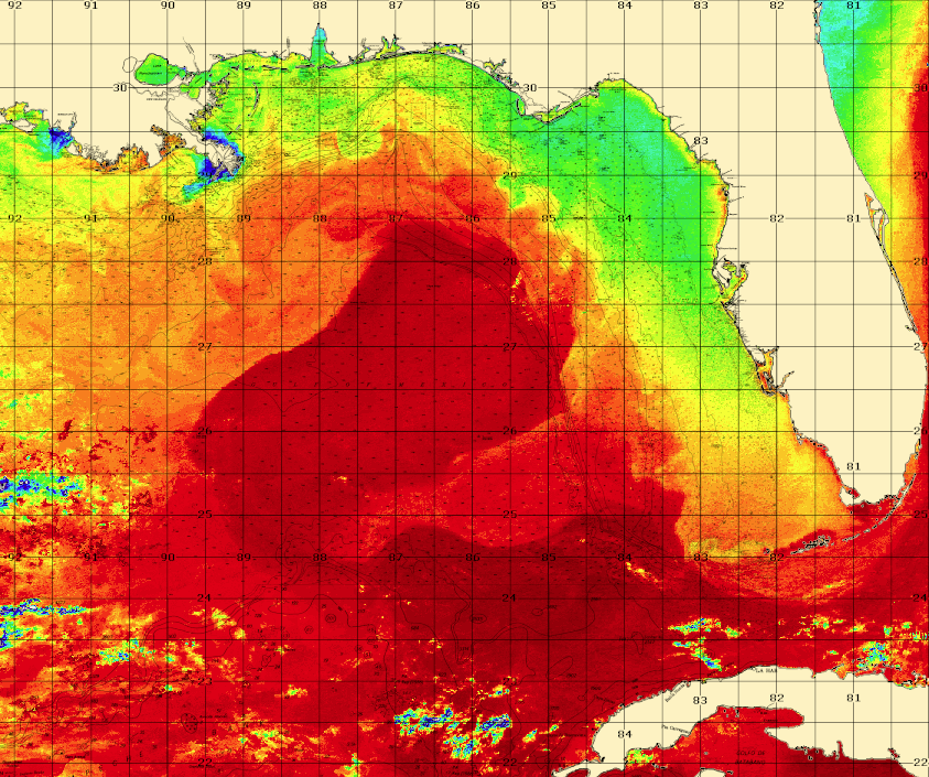
This is a movie created by putting together infrared satellite images from seven days from May 17-24, 2013 from the northeastern Gulf of Mexico. Each frame is from one day’s image. The darker the shade of grey, the warmer the water temperature. Some clouds (white and blue) pass through the imagery. We follow the currents by their signature surface water temperature. The Loop Current is at the bottom of the scree, but a substantial eddy is pulling dark blue Loop Current water toward the coast bringing the fish as well.
Shipping, Tow, and Rig Move Forecasts
Current and Eddy Forecast Samples